

WIRELESS CHARGING IN THE NEWS
Free path navigation (relying on environmental perception and map matching)
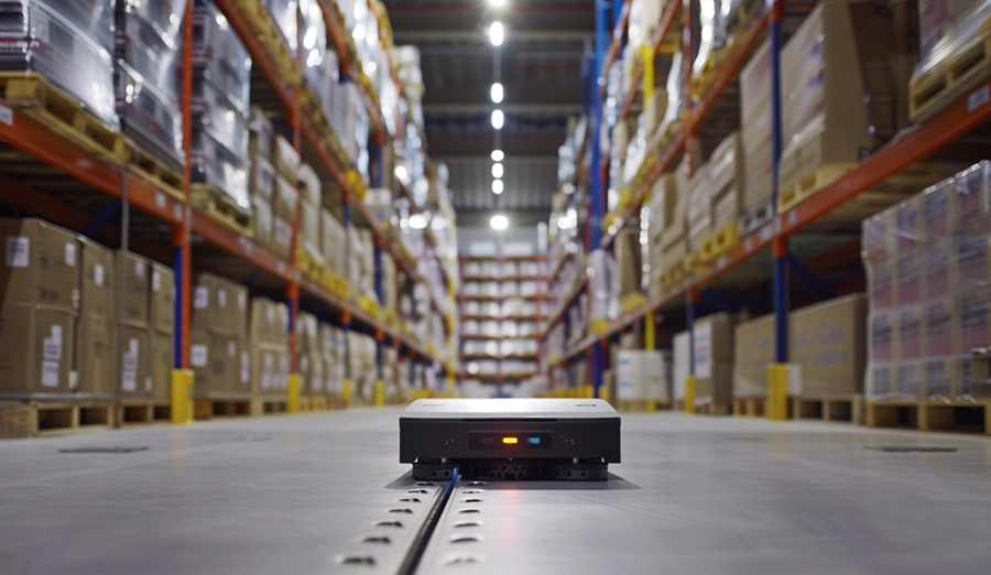
5. Laser reflector navigation
Principle: Install high reflector plates at fixed positions in the operating environment (such as walls, columns, etc.). The rotating laser scanner (LIDAR) on the top of the AGV emits laser beams and receives the signals reflected back by the reflector. By measuring the angles and distances of the reflectors and combining them with the environmental maps pre-stored in the AGV (including the precise positions of all reflectors), the position and orientation of the AGV itself are calculated in real time using triangulation or SLAM (Simultaneous Localization and Mapping) algorithms.
Advantages
Extremely high positioning accuracy: millimeter-level positioning accuracy.
Extremely high path flexibility: No ground marking is required; only reflective panels need to be installed in the environment. Path planning is fully software-ized, and changes are extremely convenient (just reset the virtual path).
Fast operating speed: It can achieve high-speed and stable operation.
High degree of intelligence: It is easy to achieve complex path planning, traffic management and obstacle avoidance.
Good environmental adaptability: Relatively low requirements for ground flatness.
Disadvantage: High cost (laser scanners are expensive); It is necessary to install and maintain the reflector network (if the reflector is blocked or moved, it will cause positioning failure). It takes time and professional skills to initially draw up plans.
6. Natural Contour Navigation (Laser SLAM without Reflector)
Principle: The laser scanner (LIDAR) on the top of the AGV continuously scans the Outlines of the surrounding environment (such as walls, machines, shelves, columns and other fixed objects). By matching the real-time scanned point cloud data with the high-precision environmental map pre-constructed and stored in the AGV (using the SLAM algorithm), the precise position and orientation of the AGV can be calculated in real time. There is no need to install artificial reflectors.
Advantages
No auxiliary marking required: Minimize environmental modification to the greatest extent and achieve the fastest construction deployment.
The highest path flexibility: Fully software-defined paths, making changes the most convenient.
High positioning accuracy: Close to the accuracy of laser reflector navigation.
High degree of intelligence: Supports complex applications.
Stronger environmental adaptability: Better able to adapt to environments with little dynamic change (the map needs to be updated).
Disadvantage: The highest cost (relying on high-performance lasers and powerful computing power); It has a high requirement for environmental stability. Significant changes in the environment (such as the movement of a large amount of goods or major layout alterations) may lead to positioning drift or failure, and the map needs to be updated. The algorithm is complex and has high requirements for computing resources. Positioning may be unstable in long corridors or open areas with scarce features.
7. Visual navigation
Principle
Landmark type: Set up artificial visual tags such as QR codes, Apriltags, and ArUco on the ground or at specific locations (ceilings, walls). Agvs identify tags through cameras and calculate their positions and directions relative to the tags (similar to QR code navigation, but with larger and sparser tags).
SLAM type: AGVs capture environmental images in real time through cameras (monocular, binocular, fisheye), extract feature points (such as corners and textures), and combine data from sensors such as odometers and IMUs (inertial Measurement units). They use visual SLAM algorithms to construct environmental maps in real time and simultaneously perform self-positioning. No manual labeling is required.
Advantages
Rich in information: The camera can obtain abundant environmental information (color, texture, depth).
SLAM without Physical markers: SLAM-type visual navigation does not require any ground or wall markers.
Cost potential: The cost of cameras is relatively lower than that of lidar.
Scalability: Visual information can be used for other tasks (such as code reading and object detection).
Disadvantage
It is extremely sensitive to changes in environmental light: strong light, weak light, shadows and reflections all seriously affect the effect.
It is greatly influenced by visual features: It performs poorly in environments with single textures, repetition, and a large number of dynamic objects.
High computational complexity: The VSLAM algorithm is complex, presenting significant challenges in terms of real-time performance, accuracy, and robustness (compared to laser SLAM).
Relatively low accuracy (especially for SLAM) : Generally, the positioning accuracy is not as stable and high as that of laser navigation.
High maintenance requirements: The camera lens needs to be kept clean.


 AGV/AMR Manufacturing Wireless Charging Solution
Inspection Robot Wireless Charging Solution
Mining Explosion-proof Wireless Charging Solution
Service Robot Wireless Charging Solution
Photovoltaic Robot Wireless Charging Solution
Outdoor Cleaning Robot Wireless Charging Solution
 Contact: Ms. Yang
 +86 18678901310
 luyu@wireless-power.com.cn
 801, 8th Floor, Building 1, Huizhiyuan, 117 Huizhiqiao Road, High-tech Zone, Qingdao,China
 WECHAT


 EN
EN

 +86 18678901310